
 Medical
 Life Sciences
 Information Communication
 Environment
 Nanotechnology / Materials
 Energy
 Manufacturing Technology
 Frontier
 Human and social sciences

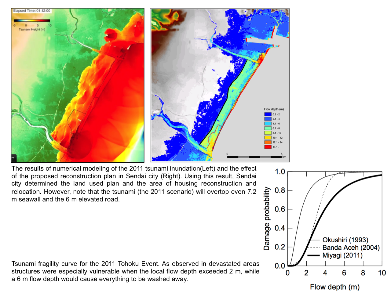
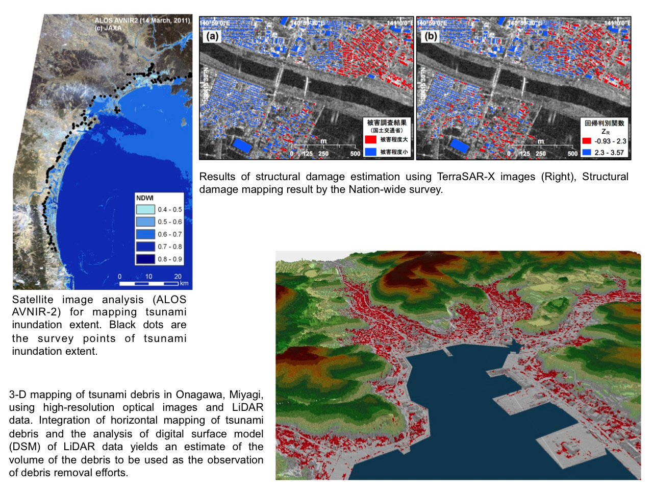
 Simulation, Remote Sensing and Geoinformatics for Disaster Management
update:2020/06/16
- Features and Uniqueness
-
With use of modern computing power, we develop a new framework to search and detect the impact of natural disaster by integrating real-time computing, damage/loss estimation models, remote sensing and geo-informatics.
The most important mission of our laboratory is to enhance the capabilities of disaster response/relief efforts and humanitarian activities by providing our research outcomes with particular regard to searching and mapping the areas and impacts of natural disasters. - Practical Application
-
Innovation in disaster management and response can be expected by fusion of high-performance real-time disaster simulation, remote sensing and geo-informatics.
- Keywords
Researchers
International Research Institute of Disaster Science
Shunichi Koshimura, Professor
Ph.D.
